map_server <- function(id, selected_species_data, use_heatmap, config) {
  moduleServer(id, function(input, output, session) {
    output$map <- renderLeaflet({
      leaflet() |>
        addTiles() |>
        setView(lng = config$MAP_CENTER_LNG, lat = config$MAP_CENTER_LAT, zoom = config$MAP_ZOOM)
    })

    observe({
      data <- selected_species_data()
      use_heatmap <- use_heatmap()

      if (!is.null(data) && nrow(data) > 0) {
        valid_data <- data[!is.na(data$latitudeDecimal) & !is.na(data$longitudeDecimal), ]
        if (nrow(valid_data) > 0) {
          map <- leafletProxy("map") |>
            clearMarkerClusters() |>
            clearHeatmap()

          if (use_heatmap) {
            map |> addHeatmap(
              data = valid_data,
              lng = ~longitudeDecimal,
              lat = ~latitudeDecimal,
              blur = config$HEATMAP_BLUR,
              max = config$HEATMAP_MAX,
              radius = config$HEATMAP_RADIUS
            )
          } else {


            map |> addMarkers(
              data = valid_data,
              lng = ~longitudeDecimal,
              lat = ~latitudeDecimal,
              popup = ~paste(
                "<strong>", scientificName, "</strong><br>",
                "Date: ", eventDate, "<br>",
                ifelse(!is.na(accessURI),
                       paste0("<img src='", accessURI, "' width='100'><br>",
                              "Image by: ", creator, "<br>",
                              "License: ", multimedia_license),
                       "No image available")
              ),
              clusterOptions = markerClusterOptions(
                showCoverageOnHover = FALSE,
                zoomToBoundsOnClick = TRUE,
                spiderfyOnMaxZoom = TRUE,
                removeOutsideVisibleBounds = TRUE,
                disableClusteringAtZoom = config$CLUSTER_ZOOM_DISABLE
              )
            )
          }
        }
      }
    })
  })
}🌿 Welcome to the Forest of Data!
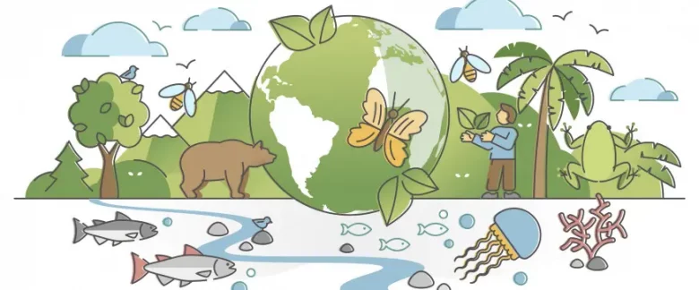
Ahoy, fellow code adventurers and nature enthusiasts! Today, we’re diving headfirst into the wild world of biodiversity data. Grab your digital binoculars, because we’re about to embark on a thrilling journey to build a Shiny app that’ll make David Attenborough jealous!
🔍 Our Mission: Operation Species Spotter
Picture this: You’re a wildlife researcher with a mountain of data and a burning question - “How have animal sightings changed over time?” Fear not! We’re crafting a tool so snazzy, it’ll turn that data mountain into a molehill faster than you can say “Marmota marmota”!
🛠️ Our Weapons of Mass Data-struction
- The Shapeshifting Maps: Different ways to visualize you data and even query the actual images.
- The All-Seeing Search Bar: A selectize input so smart, it’ll find your species faster than a cheetah chasing its lunch.
- The Time-Traveling Timeline: A plot that’ll zip through years of animal sightings quicker than you can say “Great Scott!”
Let’s peek under the hood of our biodiversity hotrod…
🎭 The Star Players in Our Data Drama
🗺️ The Cartographer’s Delight: Our Magical Map Module
Hold onto your compasses, explorers! We’re about to unfold a map so interactive!
🌋 Features That’ll Make You Erupt with Joy
Shapeshifting Views: Toggle between marker clusters and heatmaps faster than a chameleon changes colors! Popup Bonanza: Click a marker and BOOM! Species info, dates, and even glamour shots of our animal celebs! Cluster Parties: Watch as our markers gather in cliques like teenagers at a mall. Zoom in to break up the party!
🎭 The Great Heatmap vs. Marker Debate
Our map is like a secret agent with two disguises:
Heatmap Mode: Transform your map into a thermal vision of biodiversity hotspots. It’s like predator vision, but for science! Marker Mode: Unleash a confetti of markers, each hiding a treasure trove of information. It’s Where’s Waldo, but for species!
🔠 The Search Sorcerer
This little wizard conjures up species names faster than you can type “platypus”. It’s like Google for critters, but cooler!
search_server <- function(id, biodiversity_data) {
  # Server sorcery unfolds

  search_server <- function(id, biodiversity_data) {
  moduleServer(id, function(input, output, session) {
    # Prepare search data
    search_data <- biodiversity_data |>
      select(scientificName, vernacularName) |>
      distinct() |>
      mutate(search_term = paste(scientificName, vernacularName, sep = " - ")) |>
      arrange(scientificName)

    updateSelectizeInput(session, "species_search",
                         choices = setNames(search_data$scientificName, search_data$search_term),
                         selected = "Marmota marmota",
                         options = list(
                           placeholder = 'Type to search species',
                           maxOptions = 10000,  # Increase this number
                           searchField = c('value', 'label'),
                           render = I("{
                             option: function(item, escape) {
                               return '<div>' + escape(item.label) + '</div>';
                             }
                           }")
                         ))

    return(reactive({ input$species_search }))
  })
}

}
📊 The Timeline Tamer
Watch years of animal sightings dance before your eyes! This module turns boring numbers into a visual feast that would make any statistician swoon.
timeline_server <- function(id, selected_data) {
  # Data wrangling extravaganza
    timeline_server <- function(id, selected_data) {
  moduleServer(id, function(input, output, session) {
    output$timeline <- renderPlotly({
      data <- selected_data()
      if (!is.null(data) && nrow(data) > 0) {
        # Aggregate data by year
        yearly_counts <- data |>
          mutate(year = lubridate::year(eventDate)) |>
          count(year)

        # Create the base plot
        p <- plot_ly() |>
          add_trace(data = yearly_counts, x = ~year, y = ~n, type = "bar",
                    name = "Observations", marker = list(color = "#165098"))

        # Check if data spans more than one year
        if (length(unique(yearly_counts$year)) > 1) {
          # Calculate smooth regression
          loess_fit <- loess(n ~ year, data = yearly_counts, span = 0.75)
          smoothed_data <- data.frame(
            year = seq(min(yearly_counts$year), max(yearly_counts$year), length.out = 100)
          )
          smoothed_data$n <- predict(loess_fit, newdata = smoothed_data)

          # Add trend line to the plot
          p <- p |>
            add_trace(data = smoothed_data, x = ~year, y = ~n, type = "scatter", mode = "lines",
                      name = "Trend", line = list(color = "#e94560", width = 3))
        }

        # Layout (same as before)
        p <- p |>
          layout(
            title = list(text = "Observations Over Time", font = list(size = 24, color = "#ffffff")),
            xaxis = list(title = "Year", titlefont = list(size = 18, color = "#a9a9a9"),
                         tickfont = list(size = 14, color = "#a9a9a9"),
                         tickformat = "d"),
            yaxis = list(title = "Number of Observations", titlefont = list(size = 18, color = "#a9a9a9"),
                         tickfont = list(size = 14, color = "#a9a9a9")),
            legend = list(font = list(color = "#a9a9a9")),
            paper_bgcolor = "#1a1a2e",
            plot_bgcolor = "#16213e",
            margin = list(l = 80, r = 40, b = 60, t = 80, pad = 4),
            barmode = "overlay"
          )

        p
      }
    })
  })
}

}
🎢 Thrills, Spills, and Coding Chills
Building this cartographic app was no walk in the park. We faced:
The Coordinate Conundrum: We wrangled latitude and longitude like a cowboy at a rodeo. Yee-haw, data points! The Cluster Kerfuffle: We taught our markers to play nice and form orderly groups. It’s like herding cats, but with GPS! The Heatmap Hustle: We turned data density into a visual feast. It’s hotter than a jalapeño… visually speaking! The Great Data Deluge: We tamed a tsunami of biodiversity data with our bare hands (and some nifty dplyr magic)! The Single-Year Showdown: We outsmarted the dreaded “span is too small” error. Take that, statistics gremlins!
🚀 Launching Our Creation into the Wild
rsconnect::deployApp()🔮 The Future is Wild
With our map module, you can:
Zoom from continent to backyard faster than you can say “biodiversity hotspot” Uncover species hangout spots like a nature paparazzi Play “Six Degrees of Species Separation” with our interconnected data points Search for species faster than a peregrine falcon in a nosedive Watch observation trends unfold like a time-lapse of a blooming rainforest Impress your scientist friends at parties (because who doesn’t talk about R at parties?)
But wait, there’s more! Imagine if this app could:
Time-travel through species migrations (DeLorean not included) Predict future animal meetup spots (like Tinder, but for wildlife) Generate 3D holograms of habitats (Star Wars, eat your heart out!) Map species like a GPS for the animal kingdom Predict animal trends better than a psychic octopus Generate David Attenborough-style narration for each species (okay, we’re dreaming big here)
So there you have it, folks! Our map module isn’t just a feature, it’s a portal to adventure. It’s not just showing where animals have been spotted; it’s inviting you to become the next great explorer from the comfort of your laptop. Remember, in the world of biodiversity data, X marks the spot… and we’ve got all the Xs you could ever want! Now go forth and map your way to glory!
🎉 The Grand Finale
There you have it, folks!
We’ve just built the Swiss Army knife of biodiversity visualization. It slices, it dices, it even makes julienne fries! (Okay, maybe not that last part.) Remember, in the jungle of data, the prepared coder is king. So go forth, explore, and may your plots be ever in your favor!
Notes
P.S. No animals were harmed in the making of this Shiny app, but several keyboards were tickled mercilessly.